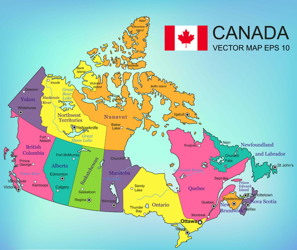
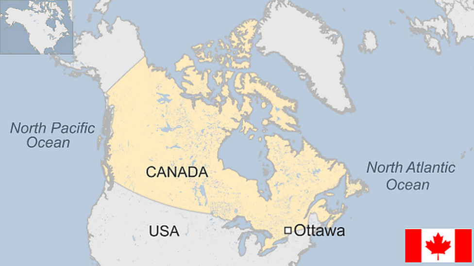
Understanding Canada Map through its map reveals a vast and diverse landscape. Covering approximately 9.98 million square kilometers, Canada is the second-largest country in the world. Its map showcases not only its immense size but also its geographical variety, from the Arctic tundra in the north to the lush forests and prairies in the south. Each region offers a unique blend of natural beauty and cultural heritage, making the Canada Map a fascinating subject for exploration.
Table of Contents
Provinces and Territories
Canada consists of ten provinces and three territories, each with distinct characteristics and attractions. The provinces include:
- Ontario: Known for the vibrant city of Toronto and the capital city, Ottawa.
- Quebec: Famous for its French-speaking population and the historic city of Montreal.
- British Columbia: Home to Vancouver and stunning coastal landscapes.
- Alberta: Known for the Rocky Mountains and cities like Calgary and Edmonton.
- Manitoba: Renowned for its prairies and the city of Winnipeg.
- Saskatchewan: Characterized by vast fields and the city of Regina.
- Nova Scotia: A maritime province with scenic coastlines and the city of Halifax.
- New Brunswick: Known for its forests and the Bay of Fundy.
- Prince Edward Island: Famous for its red sand beaches and as the setting of “Anne of Green Gables.”
- Newfoundland and Labrador: Known for rugged coastlines and St. John’s city.
The territories include:
- Yukon: Known for its mountainous regions and historical significance in the Klondike Gold Rush.
- Northwest Territories: Home to the Mackenzie River and Great Slave Lake.
- Nunavut: The largest and northernmost territory, known for its Inuit culture and arctic landscapes.

Major Cities and Landmarks
The map of Canada is dotted with major cities and landmarks that define its regions. Toronto is the largest city, known for the iconic CN Tower. Montreal blends French and English cultures and is known for its festivals and historical architecture. Vancouver is renowned for its scenic beauty and mild climate. Calgary is famous for the Calgary Stampede and proximity to Banff National Park.
Landmarks such as Niagara Falls, the Rocky Mountains, and the Great Lakes are integral parts of Canada’s natural beauty. The Canadian Shield, a vast area of ancient rock, covers a significant portion of the country, highlighting its geological diversity.
Geographic Features
Canada’s geographic features include vast mountain ranges like the Rockies and the Appalachian Mountains. The Great Plains span several provinces, providing fertile ground for agriculture. Canada is also home to extensive river systems, including the St. Lawrence River, the Mackenzie River, and the Fraser River.
The country boasts numerous lakes, with the Great Lakes being the most famous. The arctic regions feature tundra landscapes, while the southern regions offer a mix of forests, grasslands, and coastal areas. This diversity is reflected in the varied climate zones across the map, from arctic conditions in the north to temperate climates in the south.
Cultural and Natural Heritage
The map of Canada also highlights the rich cultural and natural heritage of the nation. Indigenous communities have lived across these lands for thousands of years, and their influence is seen throughout the country. Many place names, landmarks, and cultural practices are rooted in Indigenous traditions.
Canada’s national parks, such as Banff, Jasper, and Gros Morne, preserve the natural beauty and biodiversity of the country. These parks offer opportunities for hiking, wildlife viewing, and experiencing the pristine environments that Canada is known for.

Conclusion
Exploring the map of Canada offers a window into the country’s immense and diverse landscape. From its bustling cities to its tranquil natural settings, each region of Canada provides unique experiences and insights. Understanding the geography, provinces, territories, major cities, landmarks, and cultural heritage through the map enhances appreciation for this vast and beautiful nation.
FAQs About the Canada Map
What are the major geographical regions of Canada?
Canada is divided into several major geographical regions: the Canadian Shield, the Appalachian Mountains, the Interior Plains, the Western Cordillera, the Arctic Archipelago, and the Great Lakes-St. Lawrence Lowlands. Each region has distinct physical features, climates, and natural resources.
How many provinces and territories are in Canada?
Canada has ten provinces and three territories. The provinces are Ontario, Quebec, British Columbia, Alberta, Manitoba, Saskatchewan, Nova Scotia, New Brunswick, Prince Edward Island, and Newfoundland and Labrador. The territories are Yukon, Northwest Territories, and Nunavut.
What are some key cities to know on the Canada map?
Key cities on the Canada map include Toronto (Ontario), Montreal (Quebec), Vancouver (British Columbia), Calgary (Alberta), Ottawa (Ontario), Edmonton (Alberta), Winnipeg (Manitoba), Quebec City (Quebec), and Halifax (Nova Scotia). Each city has unique attractions and cultural significance.
How does the Canada map highlight the country’s natural landmarks?
The Canada map showcases natural landmarks such as the Rocky Mountains, Niagara Falls, the Great Lakes, the Canadian Shield, and the Arctic tundra. National parks like Banff, Jasper, and Gros Morne are also prominent, reflecting the country’s commitment to preserving its natural beauty.
Why is the Canadian Shield significant?
The Canadian Shield is a vast area of ancient rock that covers much of eastern and central Canada. It is significant for its rich mineral deposits, including nickel, gold, silver, and copper, and its contribution to Canada’s diverse landscape, with numerous lakes and forests.
How are the provinces and territories different?
Provinces have more autonomy from the federal government than territories, with jurisdiction over areas like education, health care, and transportation. Territories have less population and rely more on federal government support for these services. Each province and territory has its own unique culture and identity.
What are the primary rivers in Canada?
Primary rivers in Canada include the St. Lawrence River, the Mackenzie River, the Fraser River, the Columbia River, and the Yukon River. These rivers play crucial roles in transportation, commerce, and natural ecosystems.
How does the climate vary across Canada?
Canada’s climate varies significantly across its vast territory. The north experiences arctic conditions, with extremely cold winters and short, cool summers. The southern regions have temperate climates with four distinct seasons. Coastal areas like British Columbia have milder, wetter climates due to oceanic influences.
What cultural aspects are reflected in the Canada map?
The Canada map reflects the diverse cultural heritage of the nation, including Indigenous communities with deep-rooted histories across various regions. French and British influences are prominent in provinces like Quebec and Ontario. The multicultural population contributes to the rich cultural tapestry seen across the country.
What role do national parks play in Canada?
National parks in Canada, such as Banff, Jasper, and Gros Morne, play a vital role in preserving the natural environment and biodiversity. They offer protected areas for wildlife, opportunities for outdoor recreation, and help in conserving Canada’s natural heritage for future generations.
Understanding the Canada map provides valuable insights into the country’s geography, cultural diversity, and natural beauty. Whether exploring major cities, natural landmarks, or the distinct regions, the map of Canada is a gateway to discovering all that this expansive and varied country has to offer.


